Analysis of Solar Radiation Potential in Charleston, South Carolina
View Project Presentation (PDF)
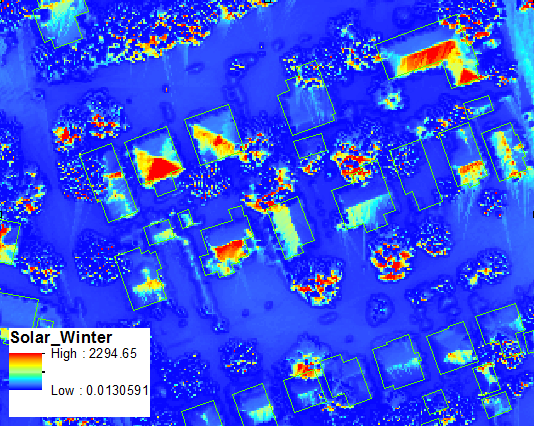
As part of MEA582 (Geospaital Modeling and Analysis), I used LiDAR data to analyze the solar rooftop capacity of buildings in Charleston, South Carolina. The main goal of the project was to identify solar rooftop potential differences between urban and residential environments, and provide a visual means to communicate this to consumers.
Below is a screenshot that visualizes solar radiation values for rooftops in a residential setting: